

Seterra is an app for mobile devices and desktop computers that helps teachers to impart knowledge of locations and names of cities, regions, continents, countries, rivers, lakes, seas, oceans and even planets of the solar system.
Image: Seterra website
For teachers it is a challenge to get students to learn the location and names of countries, cities or capitals of the world; also, it is complicated to get attention in class. Seterra is a tool that through games helps teachers impart active and fun geography lessons.
Seterra is an application for mobile devices and desktop computers with about 200 activities to learn geography. This tool aims to simplify the learning of the locations and names of cities, regions, continents, countries, rivers, lakes, seas, oceans and even planets of the solar system.
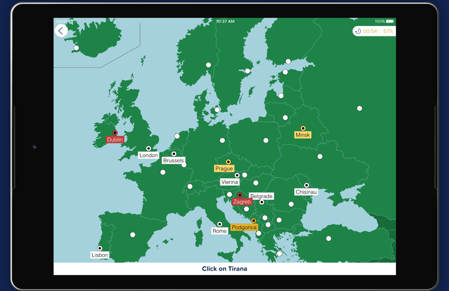
This app has six different modes. For instance, the identification mode, called “Pin” mode, where students identify regions by clicking on locations; the label mode, in which students write on the map the indicated places; or the coincidence mode, in which the names of the places are matched with the areas designated by the pins on the map. Also, it has a voice function that allows you to hear how the names of places are pronounced in different languages.
Seterra is free to download; however, it requires a payment to unlock all its functions.
The desktop version has games in 34 languages and the Android or IOS mobile app is available in English, German, French, Spanish and Swedish. All games work online or offline.
Here is an example of an activity in the Seterra app:


Paulette Delgado
Paulette Delgado
Paulette Delgado